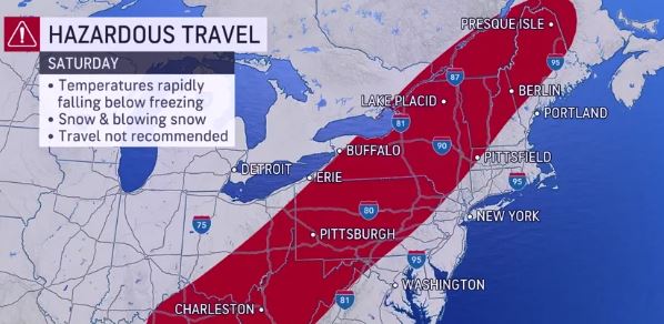
Severe Storm to Sweep the East Coast from Florida to Maine: A Weather Advisory

A powerful storm system is set to impact a vast stretch of the East Coast, from Florida to Maine, causing concerns about heavy rain, strong winds, and potential flooding. This storm, expected to last from Saturday into Monday, poses significant challenges for the affected regions, especially given its timing during the holiday travel period.
Florida to Bear the Initial Brunt
The storm is predicted to begin its onslaught in Florida on Saturday afternoon, bringing with it severe thunderstorms, potential tornadoes, and strong winds. This weather system could cause significant disruptions in Florida, including outdoor holiday parties being canceled and outside decorations being at risk of blowing away. Cities like Miami, Orlando, Tampa, and Jacksonville are expected to experience the worst of these conditions. The Florida State Guard has been activated in anticipation of the storm’s impact.
Northward Progression with Intensifying Conditions
As the storm progresses northwards, conditions are expected to deteriorate rapidly from Sunday to Sunday night. The storm is forecasted to produce heavy rain, with some areas potentially experiencing record-breaking rainfall. Coastal areas from Georgia to South Carolina are particularly at risk of flooding and flash flooding due to the predicted 2-4 inches of rain, with locally higher amounts possible.
The storm’s impact will not be limited to heavy rain. Strong winds are also a significant concern, with gusts ranging from 40 to 60 mph, and possibly reaching up to 70 mph along the coast. This can result in widespread power outages, beach erosion, and damage to beach structures. The storm may also come close to being classified as a “bomb-cyclone,” a term used to describe a rapidly intensifying storm system.
Maine’s Preparation for the Storm
In Maine, the incoming storm is anticipated to bring high winds and heavy rain, posing threats of flooding and power outages, especially early Monday morning. The state is under a high wind watch, with gusts exceeding 50 to 60 mph possible in certain areas. A flood watch covers nearly all of Maine, with significant rainfall expected Sunday night into Monday morning. The Kennebec River Valley, in particular, might see rainfall rates of more than 1 inch per hour and totals near 4 inches. The heavy rain combined with high dew points could also cause rapid snowmelt on streams and creeks.
Impact on Holiday Travel
The timing of the storm coincides with the peak holiday travel period, raising concerns about disrupted travel plans. Road travel is likely to be slowed, and air travel may also be affected. Commuters in major cities like Boston and New York can expect challenging conditions on Monday morning. The weather system’s severity underscores the need for caution and preparedness among residents and travelers alike.
This intense storm, spanning a significant portion of the East Coast, highlights the importance of weather preparedness and the need for caution during extreme weather events. Residents and travelers in the affected regions should stay informed, follow local advisories, and make necessary preparations to mitigate the impact of this severe weather system.


